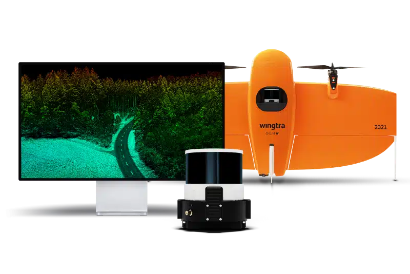
Wingtra LIDAR Bundle for WingtraRAY
The WingtraRAY LiDAR Bundle offers a high-accuracy, integrated solution for vegetation penetration and terrain mapping, featuring a Hesai laser scanner, NovAtel GNSS, and IMU for precise 3D point clouds with vertical accuracy down to 3 cm. It’s designed for rapid deployment on the WingtraRAY drone, includes essential software (Wingtra LIDAR app & LiDAR360) for processing, and streamlines the entire workflow from data capture (under canopy) to CAD/GIS-ready outputs, ideal for mining, construction, and environmental surveys.
What’s Included:
- LiDAR Payload (Hesai Sensor, GNSS, IMU).
- PPK Module & Software License (usually 1 year).
- Batteries, Charger, Hard Case, Accessories.
Ideal Applications:
- Mining: Stockpile volume, terrain modeling.
- Construction: Site planning, earthworks.
- Environmental: Forestry, vegetation management, flood mapping.
- Urban Planning: Detailed city modeling.