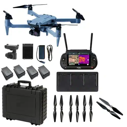
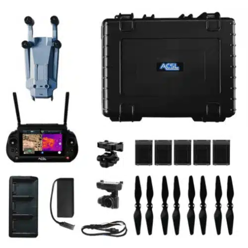
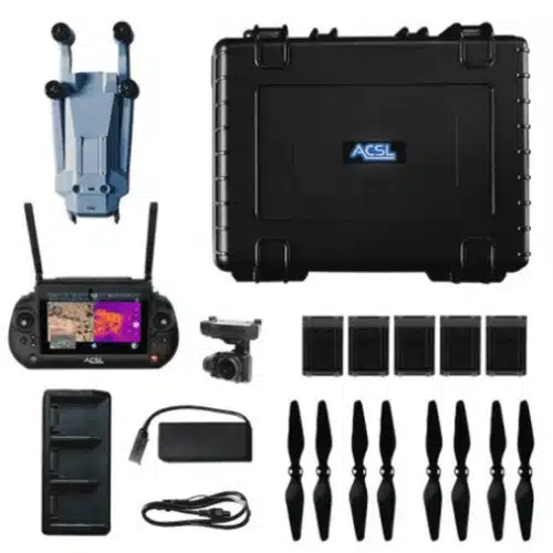
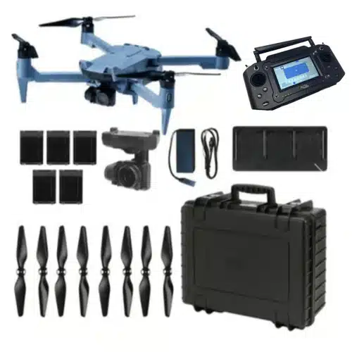
With swappable cameras, obstacle avoidance, encrypted data handling, IP43-rated durability, and five smart batteries, this bundle helps crews capture detailed data while staying productive in the field.
Featuring a 20MP swappable camera, encrypted communications, a daylight-readable smart controller, and five total batteries, it gives field teams a portable platform for dependable data capture.
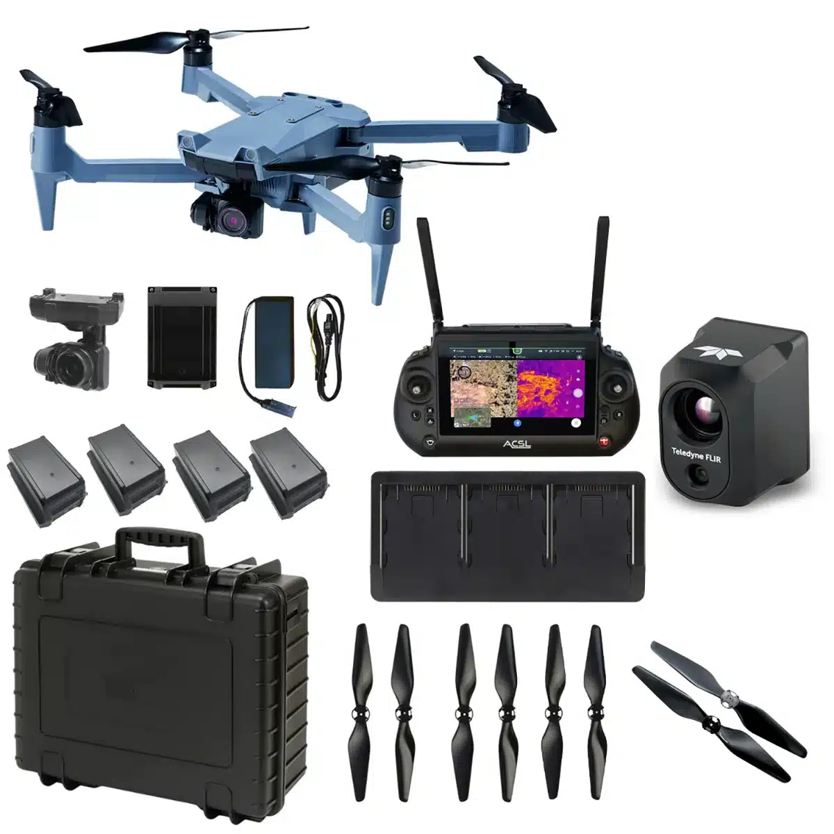
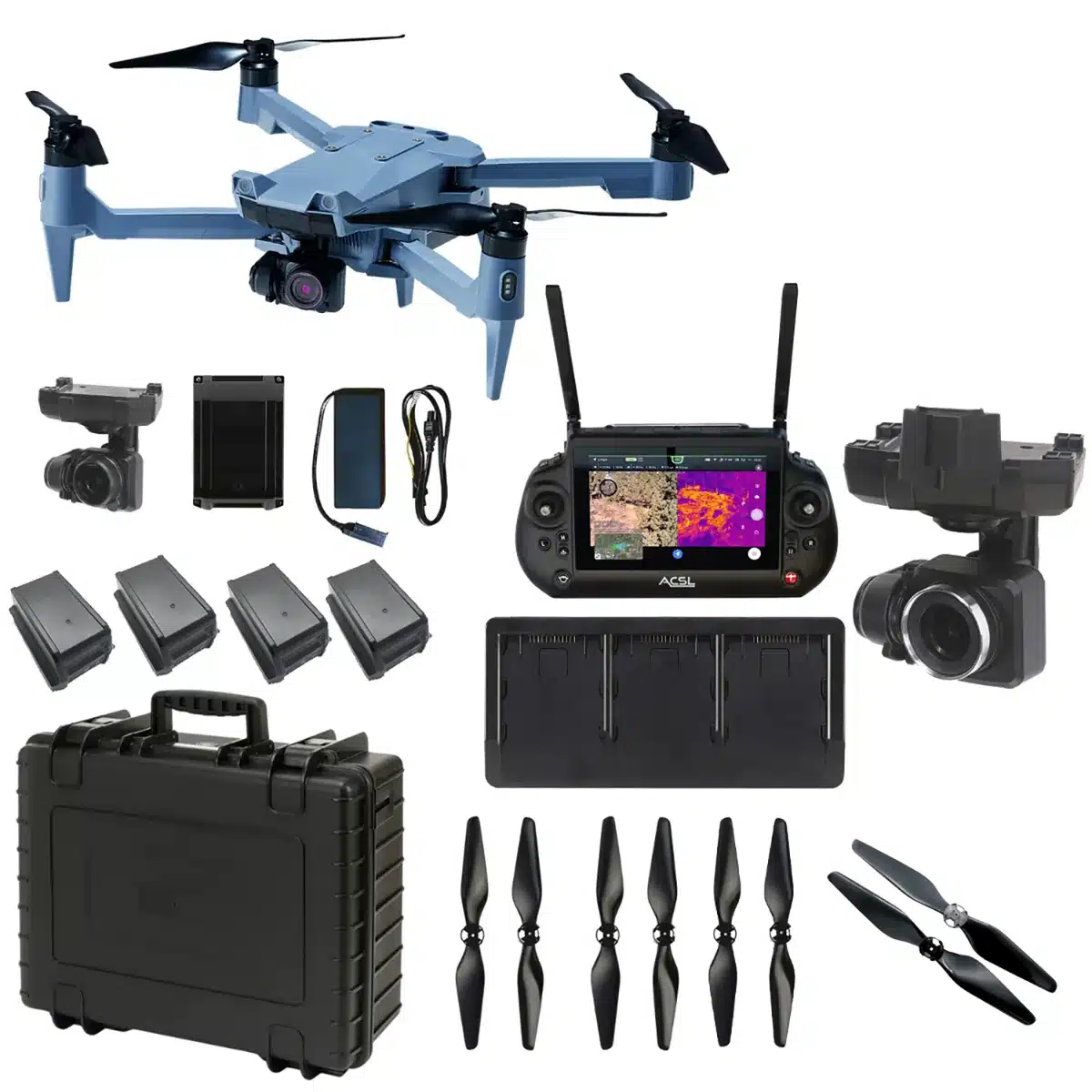
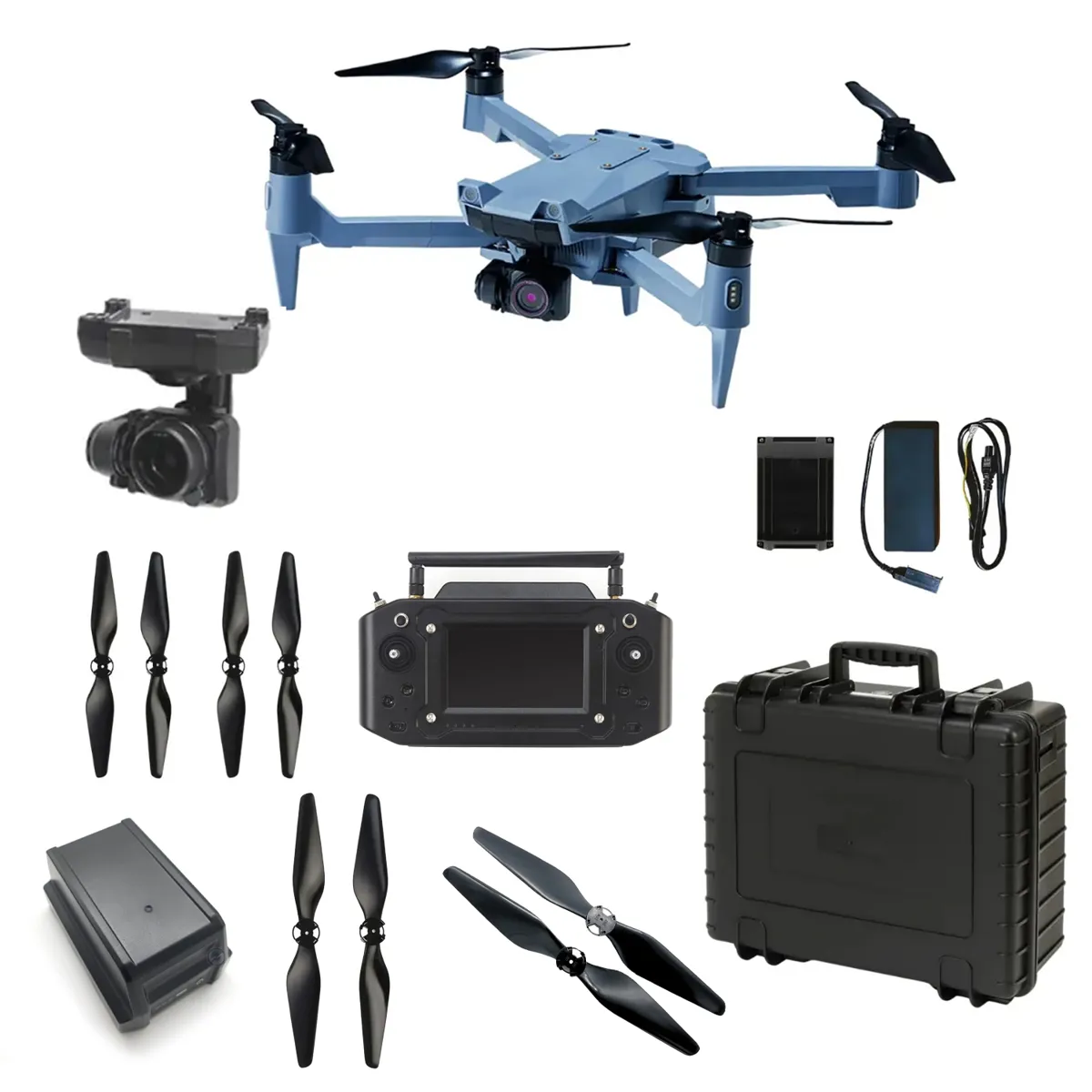
A compact, NDAA-compliant drone platform with the FLIR Hadron 640R radiometric thermal camera for professional inspection, public safety, infrastructure, and environmental monitoring missions.
Experience the future of data capture with Seiler GeoDrones. Our advanced UAS platforms, high-accuracy payloads, and integrated software workflows are built to deliver precise, efficient results on every project. From aerial mapping and inspection to seamless processing in tools like Trimble Access and Trimble Business Center, we provide everything you need to turn flight data into actionable insights. Don’t just take our word for it—see it in action. Request a demo today and discover how GeoDrones can elevate your reality capture workflow.