Mapping & Survey

Drones are rapidly transforming geospatial and surveying practices, offering unprecedented efficiency and accuracy. While historical limitations hindered their widespread adoption, recent technological advancements have solidified their position as indispensable tools in the mapping and survey industry.

Increased Efficiency

Reduce fieldwork time and processing effort, accelerating timelines and improving client satisfaction.

Improved Safety

Replace ground surveying in hazardous areas, minimizing personnel risks and liability exposure.

Enhanced Data

Capture high-resolution data with greater density for more detailed, accurate area representation.

Solutions to power every phase of your project

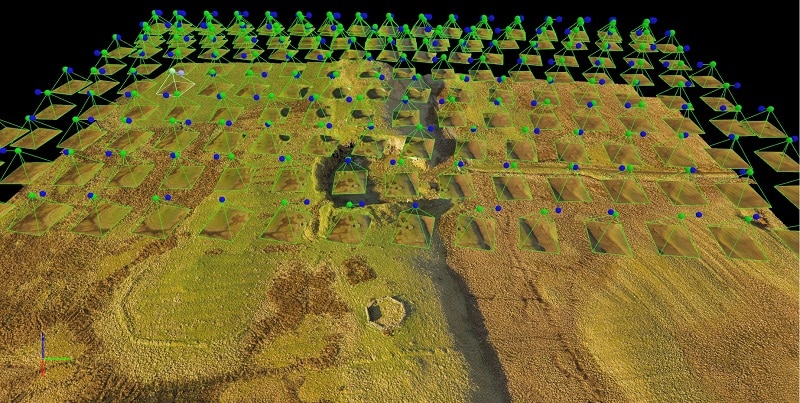
Transforming geospatial practices with advanced drone technology and precision surveying solutions

Topography

Drones equipped with RTK/PPK systems achieve centimeter-level accuracy, producing detailed topographic maps for construction, infrastructure planning, and environmental monitoring projects.

Volumetrics

Quickly and accurately calculate precise volumes of stockpiles, excavations, and other earthworks, streamlining material management and cost estimation for survey clients.

3D Modeling

Capture high-resolution imagery and LiDAR data to generate detailed 3D models of terrain and infrastructure, creating digital twins for analysis and visualization.

Corridors

Map linear infrastructure corridors including roads, railways, and pipelines efficiently. Beyond Visual Line of Sight (BVLOS) waivers enable extended corridor mapping applications.

Environmental

Monitor erosion patterns, track vegetation changes, and assess environmental impacts, supporting environmental management and conservation planning efforts.

Disaster Response

Rapidly assess damage after natural disasters, providing critical surveying information for emergency response teams and recovery operations.
Click to access the login or register cheese