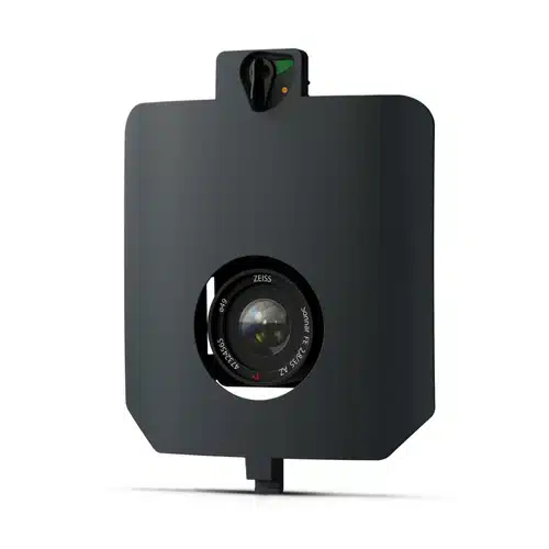
WingtraRAY SURVEY61 Payload
The WingtraRAY SURVEY61 Payload combines a 61 MP full-frame sensor with a low-distortion 35 mm lens, enabling high-precision mapping down to 0.5 cm / 0.2 in GSD. Capture up to 310 ha / 770 ac per flight at 400 ft with survey-grade accuracy—ideal for urban planning, construction monitoring, and large-scale topographic projects.
Features
- Survey-grade accuracy: horizontal / vertical RMS ≤ 3 cm (0.1 ft) via PPK, no GCPs.
- High resolution: nadir 61 MP sensor achieves 0.5 cm/px for detailed as-builts and BIM.
- Large coverage: map up to 770 ac in one sortie at 1.3 cm/px.
- Seamless workflow: plan, fly, and process in WingtraCLOUD for same-day orthos & DSMs.
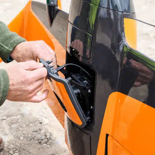
- Quick-swap design: tool-less mount lets crews change payloads in seconds.
High Quality, Swappable and Durable
- Unwavering aerial image quality: Thanks to their heavy payload capacity, the Wingtra drones carry the highest quality sensors on the market.
- Keep a lean fleet: Effortlessly switch between sensors, including high-resolution RGB cameras, multispectral sensors and advanced LIDAR, on the same drone platform.
- Protected from landing shock: Thanks to the smooth vertical landing, your high-quality sensors are always protected, even in rough environments, ensuring a longer lifespan.
Applications
WingtraRAY SURVEY61 Payload – Highest Quality Photogrammetry with Survey-Grade Accuracy