
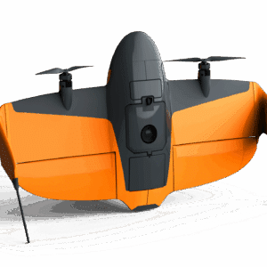
Designed for enhanced stability, control, and wind resistance for the SkyScout drone.
Designed for enhanced stability, control, and wind resistance for the SkyScout drone.
WingtraRAY - your backbone for aerial insights incl. PPK, OS and Apps
Select the terms
Sort By
Designed for enhanced stability, control, and wind resistance for the SkyScout drone.
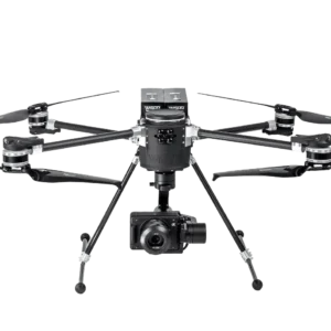
High-performance UAV platform offering advanced payload integration, extended flight endurance, and superior stability.

High-resolution aerial imaging solution designed for precision mapping, surveying, and inspection applications with the Ranger Pro platform.

Aerial mapping camera designed for precision surveying, photogrammetry, and geospatial data collection with the Ranger Pro platform.

High-performance, long-endurance power solution for the Ranger Pro UAV series.
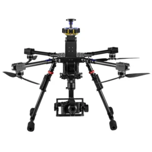
High-performance UAV featuring long-range encrypted communication, RTK navigation, and interchangeable payload support.

Gimbal system designed for stabilized aerial imaging, mapping, and surveying applications, offering seamless integration with the Ranger Pro platform.
A Sony APS-C full-frame sensor with 24.3 MP resolution with RTK and PPK compatibility.
High-performance, U.S.-made fixed-wing UAV featuring dual-band RTK navigation, interchangeable payloads, and extended flight endurance.
Fixed-wing UAV featuring long-range communication, dual-band RTK navigation, and interchangeable payloads.

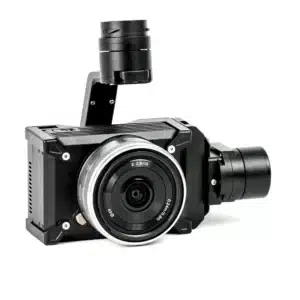
Lightweight EO/IR imaging system featuring a 4K zoom sensor, 640x512 radiometric thermal camera, and a 2400m laser rangefinder.

Featuring a 61MP full-frame sensor and advanced image processing for exceptional image quality.
Experience the future of data capture with Seiler GeoDrones. Our advanced UAS platforms, high-accuracy payloads, and integrated software workflows are built to deliver precise, efficient results on every project. From aerial mapping and inspection to seamless processing in tools like Trimble Access and Trimble Business Center, we provide everything you need to turn flight data into actionable insights. Don’t just take our word for it—see it in action. Request a demo today and discover how GeoDrones can elevate your reality capture workflow.
"*" indicates required fields