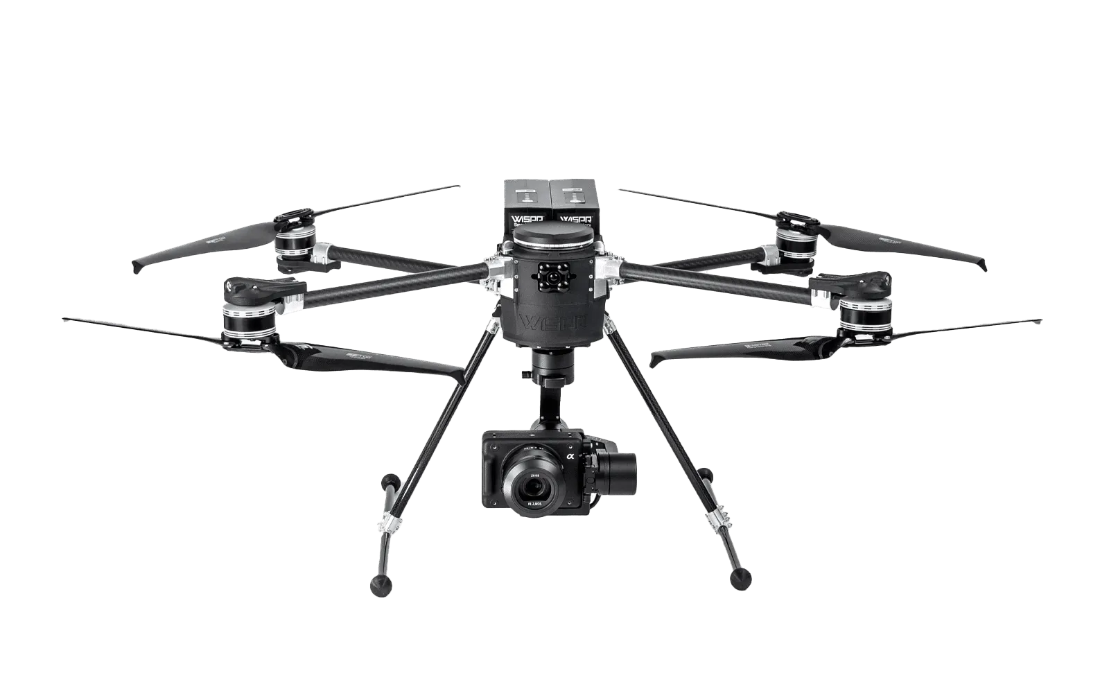
High-performance UAV featuring long-range encrypted communication, RTK navigation, and interchangeable payload support.
High-performance UAV featuring long-range encrypted communication, RTK navigation, and interchangeable payload support.
Select the Product categories
Sort By
High-performance UAV featuring long-range encrypted communication, RTK navigation, and interchangeable payload support.

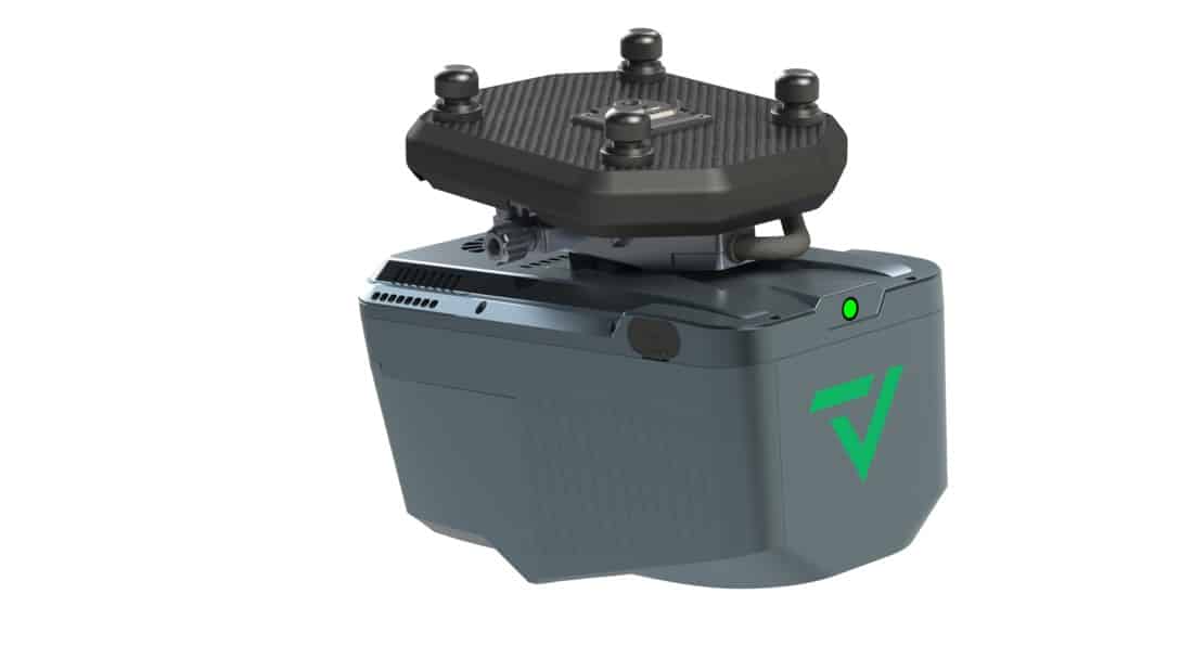
Gimbal system designed for stabilized aerial imaging, mapping, and surveying applications, offering seamless integration with the Ranger Pro platform.
Fixed-wing UAV featuring long-range communication, dual-band RTK navigation, and interchangeable payloads.
High-performance, U.S.-made fixed-wing UAV featuring dual-band RTK navigation, interchangeable payloads, and extended flight endurance.
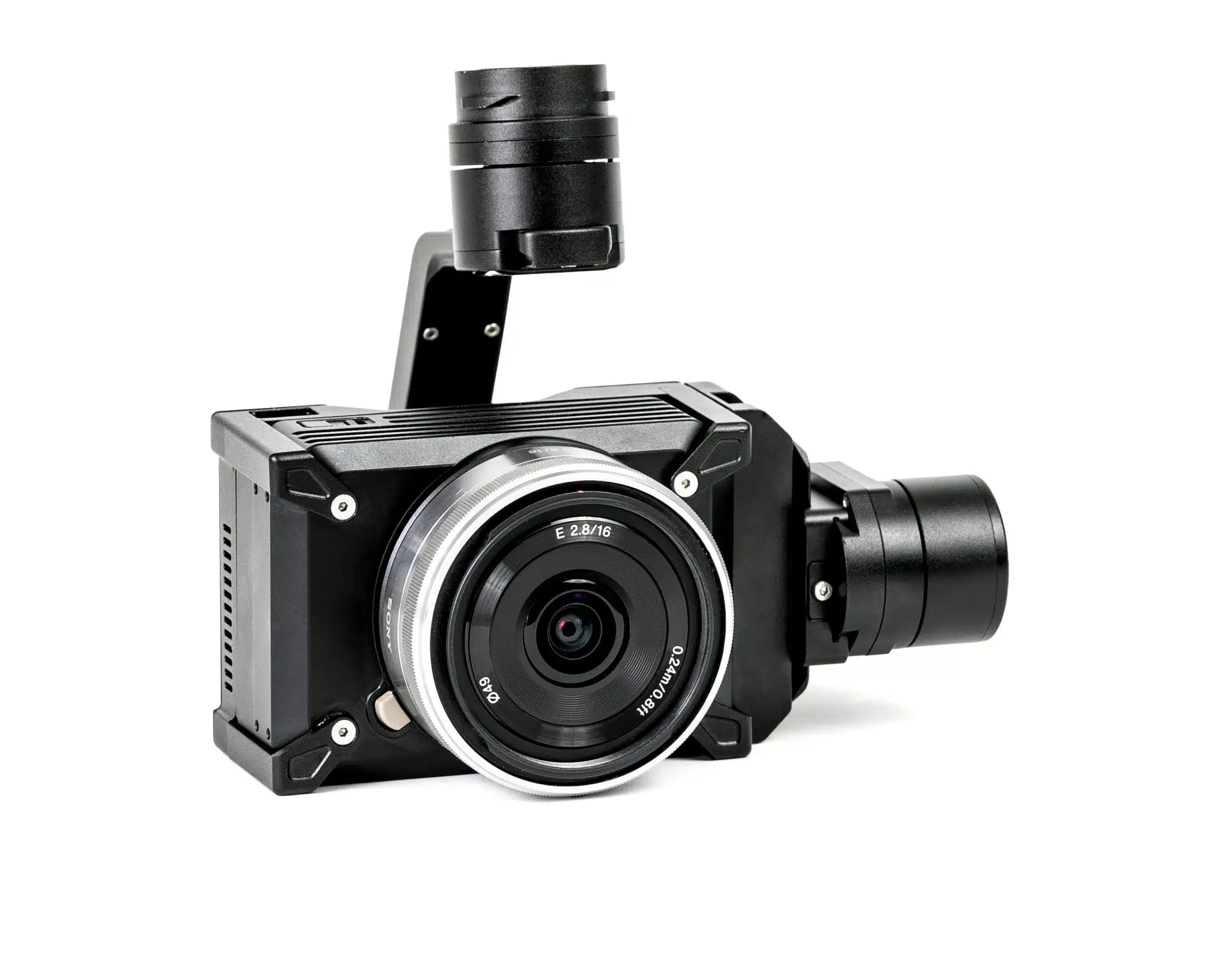
A Sony APS-C full-frame sensor with 24.3 MP resolution with RTK and PPK compatibility.

Featuring a 61MP full-frame sensor and advanced image processing for exceptional image quality.
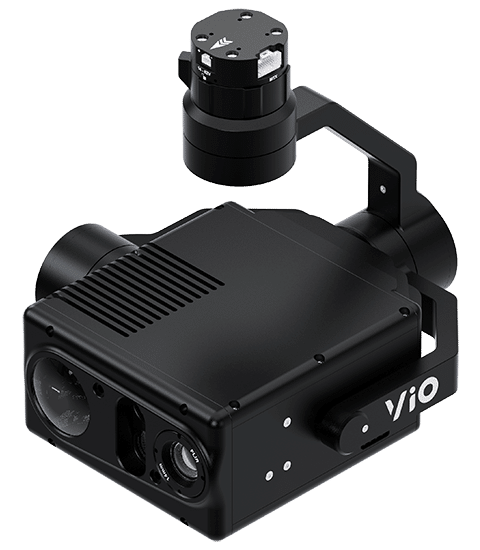
Lightweight EO/IR imaging system featuring a 4K zoom sensor, 640x512 radiometric thermal camera, and a 2400m laser rangefinder.
Lightweight LiDAR system featuring a Hesai XT-32 scanner and a FLIR 5 MP global-shutter camera.
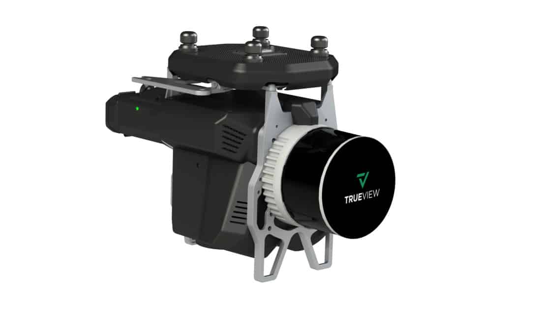
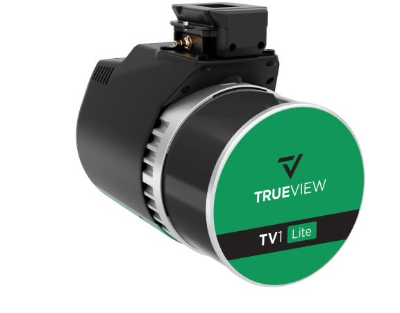
The TrueView 535 is a lightweight, high-accuracy drone LiDAR system featuring the RIEGL miniVUX-2UAV scanner and dual 20 MP cameras. It delivers survey-grade precision, dense point clouds, and high-resolution RGB imaging, making it ideal for applications such as topographic mapping, forestry, and infrastructure assessments.
The TrueView 540 is a compact, high-accuracy drone LiDAR system equipped with the RIEGL miniVUX-3UAV scanner and dual 20 MP cameras. It delivers precise point clouds and high-resolution photogrammetry, making it ideal for applications such as surveying, construction, and environmental monitoring.
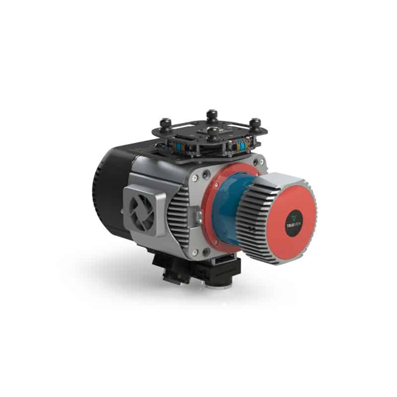
The TrueView 680 is a high-performance drone LiDAR and photogrammetry system featuring the RIEGL VUX-1UAV scanner and dual 20 MP cameras. Designed for large-scale surveying and high-precision mapping, it delivers superior accuracy, dense point clouds, and detailed RGB imagery for applications such as powerline mapping, forestry, and infrastructure assessment.
The TrueView 680 is a high-performance drone LiDAR and photogrammetry system featuring the RIEGL VUX-1UAV scanner and dual 20 MP cameras. Designed for large-scale surveying and high-precision mapping, it delivers superior accuracy, dense point clouds, and detailed RGB imagery for applications such as powerline mapping, forestry, and infrastructure assessment.
Experience the future of data capture with Seiler GeoDrones. Our advanced UAS platforms, high-accuracy payloads, and integrated software workflows are built to deliver precise, efficient results on every project. From aerial mapping and inspection to seamless processing in tools like Trimble Access and Trimble Business Center, we provide everything you need to turn flight data into actionable insights. Don’t just take our word for it—see it in action. Request a demo today and discover how GeoDrones can elevate your reality capture workflow.
"*" indicates required fields