Your cart is currently empty!
American Built, Affordable Price. Check out the all new TrueView1 LITE
WingtraOne GEN II Base Package
$19,900.00
The WingtraOne Gen II Mapping Drone Base Kit, available through Seiler GeoDrones, is a high-tech, efficient fixed-wing drone designed for aerial mapping and surveying, offering extended flight times, PPK GNSS accuracy, and VTOL capability, all in a rugged, user-friendly package.
Description
The WingtraOne Gen II Mapping Drone Base Kit, available through Seiler GeoDrones, is a high-tech, efficient fixed-wing drone designed for aerial mapping and surveying, offering extended flight times, PPK GNSS accuracy, and VTOL capability, all in a rugged, user-friendly package.
Long Description:
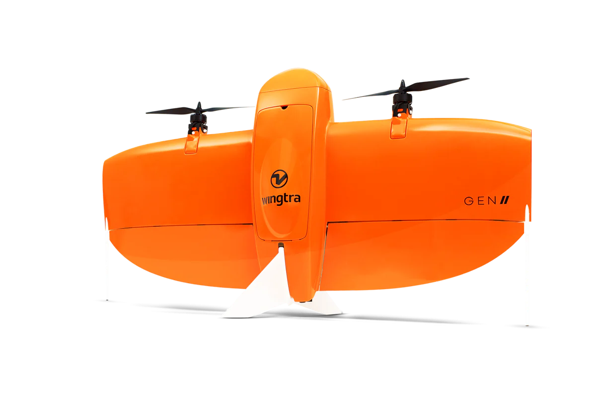
The WingtraOne Gen II Mapping Drone Base Kit, offered by Seiler GeoDrones, is the ultimate tool for survey specialists seeking efficiency and precision in aerial mapping and surveying. This high-tech, durable fixed-wing drone is engineered to optimize data collection while reducing field time and increasing productivity. With up to 60 minutes of flight time and speeds of 16 m/s (36 mph), the WingtraOne Gen II enables large coverage areas in a single flight, ideal for surveying highways, industrial complexes, mines, and other large-scale projects.
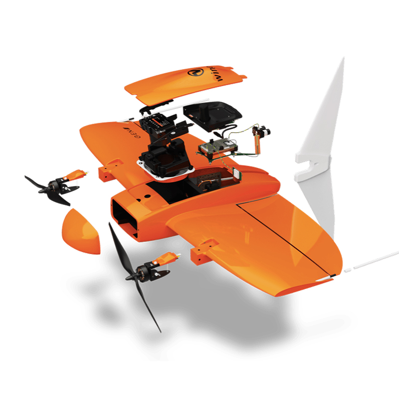
Equipped with an onboard high-precision PPK GNSS receiver, this drone eliminates the need for ground control points (GCPs), providing accurate data collection with as few as three checkpoints, saving time and effort. The drone’s high-quality optics ensure reliable map reconstruction even with lower overlaps, maximizing your coverage per flight. It is up to 11 times faster than multicopter drones, reducing man-hour costs and improving efficiency.
Designed with VTOL (Vertical Take-Off and Landing) technology, the WingtraOne Gen II can take off and land in confined spaces and rough terrain, offering versatility in hard-to-reach areas. The camera never touches the ground, preventing lens scratches and extending the equipment’s lifespan. With predictive self-diagnosis and automated safety checks, the drone performs safety diagnostics before every flight, ensuring that all components are functioning correctly.
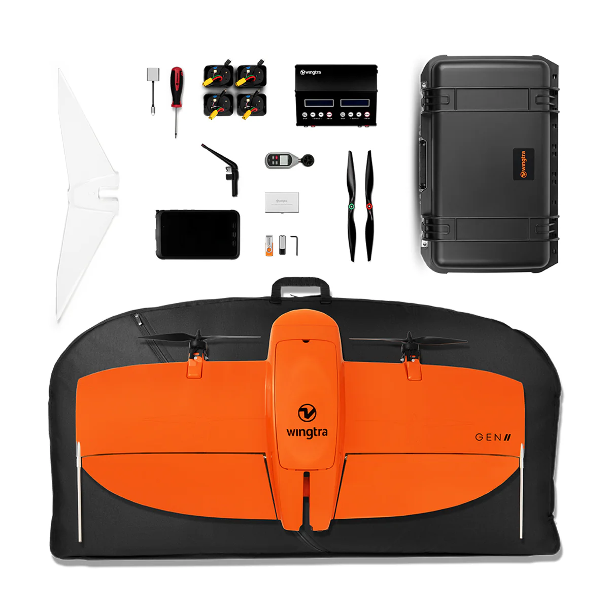
With the WingtraOne Gen II, you can fly in winds up to 12 m/s (27 mph) and gusts up to 18 m/s (40 mph), making it suitable for aerial data collection in diverse environmental conditions. The kit includes everything you need, including the WingtraPilot flight planning software, a rugged tablet, 4 batteries, charging station, spare propellers, and more.
Engineered and assembled in Switzerland, the WingtraOne Gen II undergoes over 300 rigorous tests and has a proven track record of reliability, having completed over 100,000 flights. Whether you’re working on urban mapping, land surveying, or environmental monitoring, the WingtraOne Gen II Mapping Drone Base Kit is your reliable partner for high-quality aerial mapping and data collection.
Related products

RESEPI Avia Livox 24MP Camera(FPV Gimbal)
$19,750.00
Ranger Pro +
$25,500.00
DJI Mavic 3 Multispectral
$4,959.00
DJI Zenmuse H20N
$10,769.00")
DJI Zenmuse P1 Camera
$7,230.00