Your cart is currently empty!
American Built, Affordable Price. Check out the all new TrueView1 LITE
TrueView 720 Traditional
$270,000.00
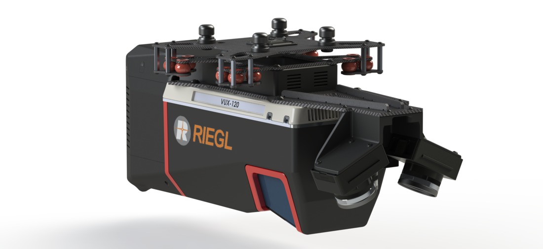
The TrueView 720 is a high-precision drone LiDAR system featuring the RIEGL VUX-120 scanner and three 26 MP cameras. It delivers survey-grade accuracy, high-density point clouds, and detailed photogrammetry for applications such as forestry, powerline mapping, and urban infrastructure projects.
Description
The TrueView 720 is a cutting-edge LiDAR and photogrammetry sensor designed for demanding geospatial applications. Equipped with the RIEGL VUX-120 LiDAR scanner and a triple-camera system, it captures high-density point clouds with superior accuracy and resolution. The system’s unique forward, nadir, and backward (FNB) scanning pattern reduces shadowing and enhances detail, making it ideal for complex environments.
Key Features:
- High Accuracy & Density – Utilizes RIEGL’s advanced LiDAR technology for precise, survey-grade data collection.
- Triple 26 MP Cameras – Provides high-resolution RGB imagery for photogrammetry and colorized point clouds.
- Efficient & Versatile – Compatible with fixed-wing and multirotor UAVs for flexible deployment.
- Optimized Data Processing – Seamlessly integrates with LP360 software for automated point cloud classification and analysis.
Related products
")
Ranger Pro 1100 Package
$18,500.00
Ranger Pro 1100 with Blue Herelink
$22,500.00
Gremsy Vio F1 (Ranger Pro)**
$15,000.00
DJI Mavic 3 Enterprise
$3,899.00
DJI Zenmuse H20N
$10,769.00