Your cart is currently empty!
American Built, Affordable Price. Check out the all new TrueView1 LITE
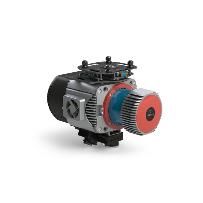
TrueView 680 Traditional + Software
$200,000.00
The TrueView 680 is a high-performance drone LiDAR and photogrammetry system featuring the RIEGL VUX-1UAV scanner and dual 20 MP cameras. Designed for large-scale surveying and high-precision mapping, it delivers superior accuracy, dense point clouds, and detailed RGB imagery for applications such as powerline mapping, forestry, and infrastructure assessment.
Description
The TrueView 680 is a premium LiDAR and imaging system built for professionals who require high-accuracy aerial data collection. Featuring the powerful RIEGL VUX-1UAV sensor, it provides survey-grade precision and long-range scanning capabilities, making it ideal for complex mapping projects. The system’s dual 20 MP cameras enhance photogrammetry applications, producing high-resolution RGB imagery and colorized point clouds. Optimized for UAV deployment, the TrueView 680 is a versatile solution for industries such as energy, construction, and environmental monitoring.
Key Features:
- High-Precision LiDAR Scanning – Utilizes the RIEGL VUX-1UAV for long-range, high-accuracy data collection.
- Dual 20 MP Cameras – Captures high-resolution RGB imagery for photogrammetry and colorized point clouds.
- Optimized for UAVs – Designed for seamless integration with drone platforms for efficient data collection.
- Advanced Data Processing – Compatible with LP360 software for automated classification, feature extraction, and analysis.
Related products

RESEPI Avia Livox 24MP Camera(FPV Gimbal)
$19,750.00
Gremsy Vio F1 (Ranger Pro)**
$15,000.00
DJI Zenmuse L2
$14,430.00
DJI Mavic 3 Thermal
$5,899.00")
DJI Zenmuse H20T
$11,339.00