Your cart is currently empty!
American Built, Affordable Price. Check out the all new TrueView1 LITE
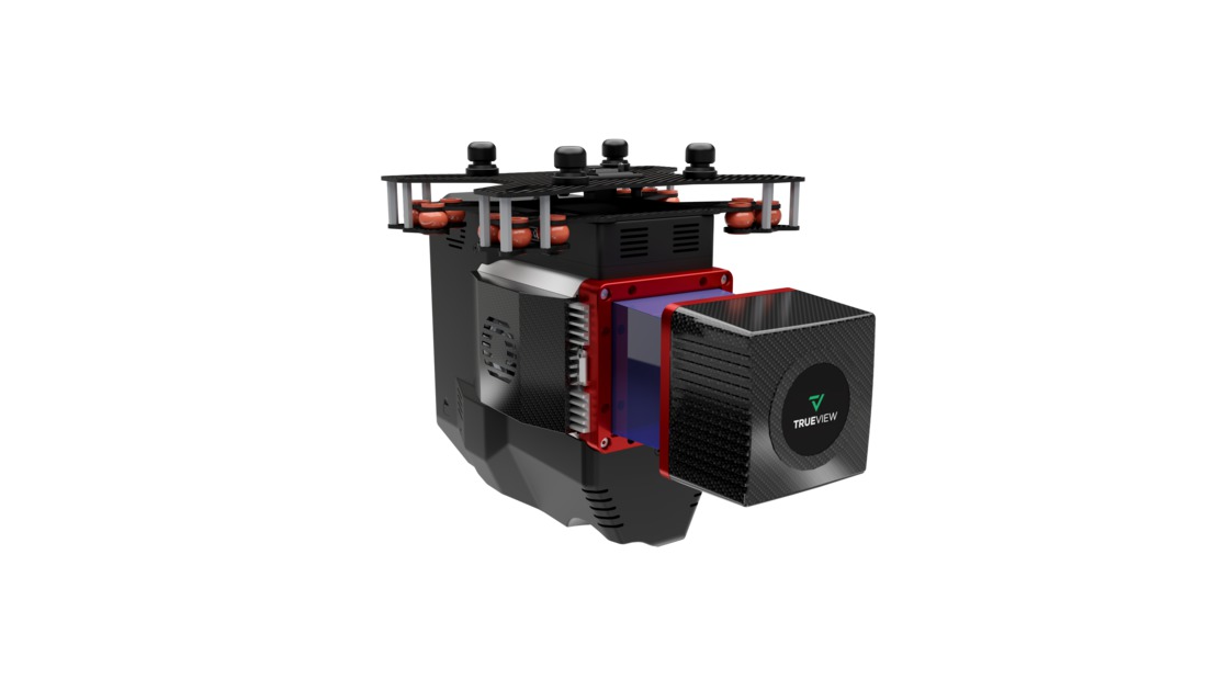
TrueView 655 Traditional + Software
$130,000.00
The TrueView 655 and 660 are advanced drone LiDAR and photogrammetry systems featuring the RIEGL miniVUX-3UAV (655) and VUX-1UAV (660) sensors, along with dual 20 MP cameras. These high-precision systems deliver exceptional accuracy, high-density point clouds, and detailed RGB imaging for applications such as corridor mapping, forestry, and infrastructure assessment.
Description
The TrueView 655 and 660 are designed for geospatial professionals who require high-accuracy LiDAR and photogrammetry solutions for UAV-based mapping. The TrueView 655 is equipped with the RIEGL miniVUX-3UAV, offering dense and accurate point clouds, while the TrueView 660 features the more powerful RIEGL VUX-1UAV, providing increased range and precision for large-scale surveys. Both models include dual 20 MP cameras for high-resolution RGB imaging, enhancing photogrammetry and colorized point cloud generation. These systems are ideal for demanding applications such as powerline mapping, urban planning, and environmental monitoring.
Key Features:
- High-Precision LiDAR Scanning – TrueView 655 features the RIEGL miniVUX-3UAV, while the 660 includes the VUX-1UAV for extended range and detail.
- Dual 20 MP Cameras – Captures high-resolution imagery for photogrammetry and colorized point clouds.
- Optimized for UAVs – Lightweight and designed for seamless integration with drone platforms.
- Advanced Data Processing – Compatible with LP360 software for automated classification, feature extraction, and analysis.
Related products
")
Ranger Pro 1100 Package
$18,500.00
DJI Mavic 3 Multispectral
$4,959.00
DJI Mavic 3 Enterprise
$3,899.00
DJI Mavic 3 Thermal
$5,899.00")
DJI DL 24mm F2.8 LS ASPH Lens
$1,299.00