Your cart is currently empty!
American Built, Affordable Price. Check out the all new TrueView1 LITE
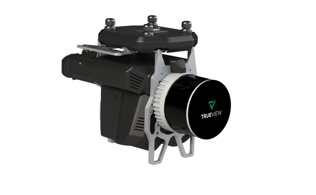
TrueView 545 Traditional + Software
$76,590.00
The TrueView 545 is a high-performance drone LiDAR and photogrammetry system featuring the RIEGL miniVUX-3UAV scanner and dual 26 MP cameras. It delivers high-accuracy, high-density point clouds for applications such as corridor mapping, forestry, and infrastructure monitoring.
Description
The TrueView 545 is a professional-grade LiDAR and imaging system designed for precision aerial mapping. Featuring the RIEGL miniVUX-3UAV scanner, it offers exceptional point density and accuracy, making it ideal for detailed topographic surveys and asset management. The system’s dual 26 MP cameras enhance photogrammetry capabilities, enabling high-resolution RGB imaging for colorized point clouds. Compact and lightweight, the TrueView 545 is optimized for multirotor UAVs, providing efficient data collection for a wide range of geospatial applications.
Key Features:
- High-Precision LiDAR Scanning – Utilizes the RIEGL miniVUX-3UAV for dense, accurate point cloud generation.
- Dual 26 MP Cameras – Captures high-resolution imagery for enhanced photogrammetry and colorized point clouds.
- Optimized for UAV Deployment – Lightweight and efficient for use with multirotor drones.
- Advanced Data Processing – Fully compatible with LP360 software for automated classification, feature extraction, and analysis.
Related products
")
55mm Lens for Sony ILX-LR1
$1,250.00
Ranger Pro +
$25,500.00")
Gremsy Zio (Ranger Pro)**
$4,995.00
DJI Mavic 3 Thermal
$5,899.00")
DJI Matrice 300 RTK
$12,179.00