Your cart is currently empty!
American Built, Affordable Price. Check out the all new TrueView1 LITE

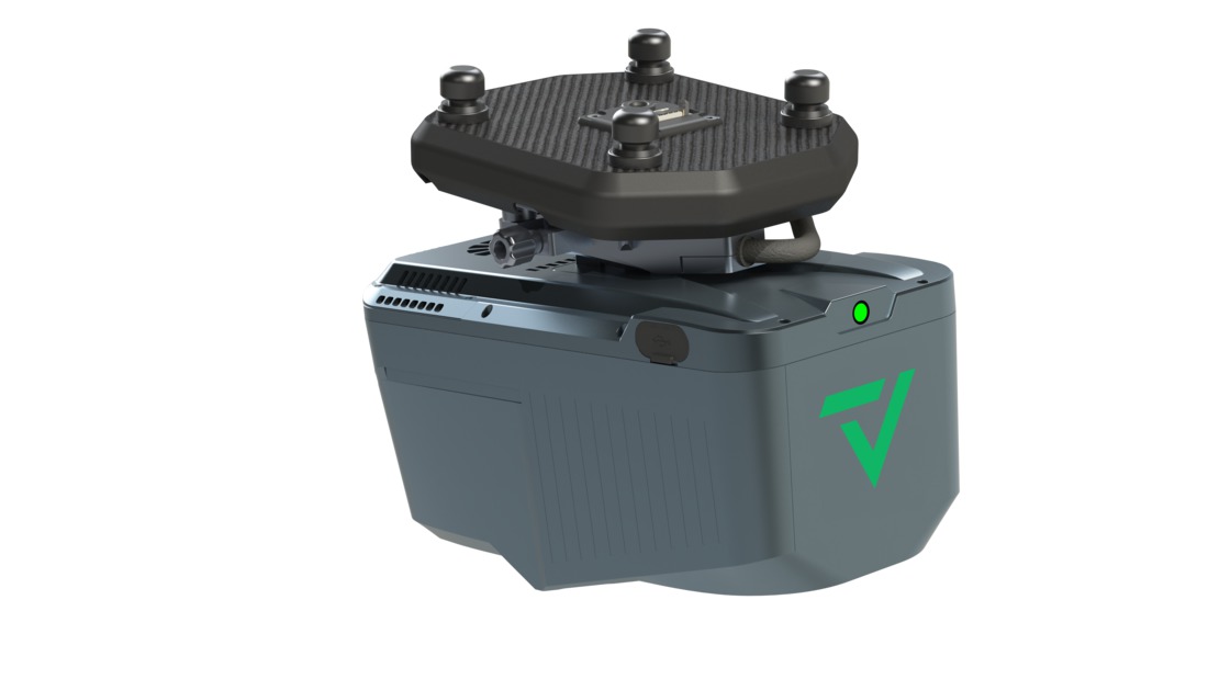
TrueView 540 Traditional + Software & Payload Interface
$79,870.00
The TrueView 540 is a compact, high-accuracy drone LiDAR system equipped with the RIEGL miniVUX-3UAV scanner and dual 20 MP cameras. It delivers precise point clouds and high-resolution photogrammetry, making it ideal for applications such as surveying, construction, and environmental monitoring.
Description
The TrueView 540 is a lightweight, high-precision LiDAR and imaging system designed for efficient aerial mapping. Featuring the RIEGL miniVUX-3UAV LiDAR sensor, it captures dense and accurate point clouds, making it well-suited for topographic mapping, infrastructure assessments, and vegetation analysis. The dual 20 MP cameras provide crisp RGB imagery for colorized point clouds and photogrammetric applications. Optimized for multirotor UAVs, the TrueView 540 offers a balance of accuracy, efficiency, and affordability for geospatial professionals.
Key Features:
- High-Precision LiDAR Scanning – Utilizes the RIEGL miniVUX-3UAV for accurate, high-density point cloud generation.
- Dual 20 MP Cameras – Captures high-resolution imagery for photogrammetry and colorized point clouds.
- Lightweight and Efficient – Designed for multirotor UAVs, enabling versatile deployment.
- Advanced Data Processing – Fully compatible with LP360 software for automated point cloud classification, feature extraction, and analysis.

")

")
")