Your cart is currently empty!
American Built, Affordable Price. Check out the all new TrueView1 LITE
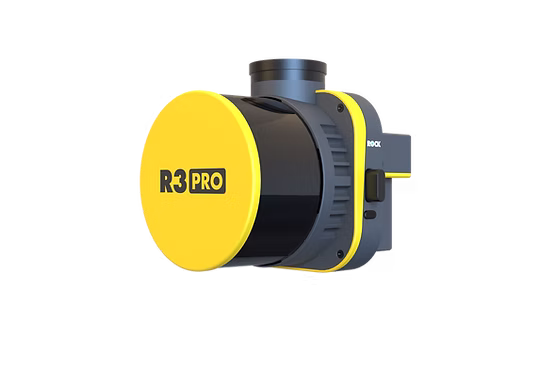
Lidar Kit – IF800 – Rock Robotic – R3 Pro
$2,500.00
The LiDAR Kit – IF800 + Rock Robotic R3 Pro, available through Seiler GeoDrones, is a high-precision aerial LiDAR system designed for advanced mapping, surveying, and geospatial data collection.
Description
The LiDAR Kit – IF800 + Rock Robotic R3 Pro, offered by Seiler GeoDrones, is a state-of-the-art aerial LiDAR solution built for high-accuracy surveying, infrastructure assessment, and terrain mapping. The IF800 UAS provides exceptional flight stability and efficiency, while the Rock Robotic R3 Pro delivers detailed 3D point clouds and advanced georeferencing capabilities. Ideal for topographic mapping, forestry analysis, and construction site monitoring, this kit ensures seamless workflow integration, superior data accuracy, and efficient aerial surveying for professional applications.
Related products

Gremsy VIO – IF1200 Payload
$15,000.00
Lidar Kit – IF1200 – Riegl MiniVux3
$2,500.00
Lidar Kit – IF800 – Inertial Labs – Resepi
$2,500.00
Lidar Kit – IF800 – PLS – Recon-XT
$2,500.00
Sony ILX-LR1- IF1200 Payload
$8,500.00