Your cart is currently empty!
American Built, Affordable Price. Check out the all new TrueView1 LITE
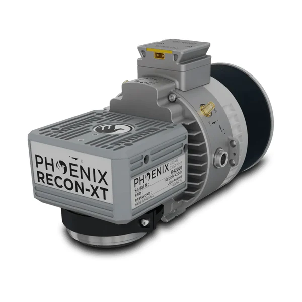
Lidar Kit – IF800 – PLS – Recon-XT
$2,500.00
The LiDAR Kit – IF800 + PLS Recon-XT, available through Seiler GeoDrones, delivers high-precision aerial LiDAR mapping and surveying, combining advanced LiDAR technology with the reliability of the IF800 UAS.
Description
The LiDAR Kit – IF800 + PLS Recon-XT, offered by Seiler GeoDrones, is a cutting-edge aerial LiDAR solution designed for high-accuracy geospatial data collection. Featuring the IF800 UAS, this system provides exceptional flight stability and efficiency for professional surveying, mapping, and infrastructure assessment. The PLS Recon-XT LiDAR sensor delivers detailed 3D point clouds, enabling precise terrain mapping, forestry analysis, and structural inspection. Built for versatility and reliability, this kit ensures seamless workflow integration, superior data accuracy, and efficient aerial surveying capabilities for mission-critical operations.
Related products

Lidar Kit – IF1200 – Riegl MiniVux3
$2,500.00
Lidar Kit – IF800 – Rock Robotic – R3 Pro
$2,500.00
Lidar Kit – IF800 – Inertial Labs – Resepi
$2,500.00-
Lidar Kit – IF800 – Riegl MiniVux3
$2,500.00 ")
Sony ILX-LR1 – IF800 Payload
$8,500.00