Your cart is currently empty!
American Built, Affordable Price. Check out the all new TrueView1 LITE
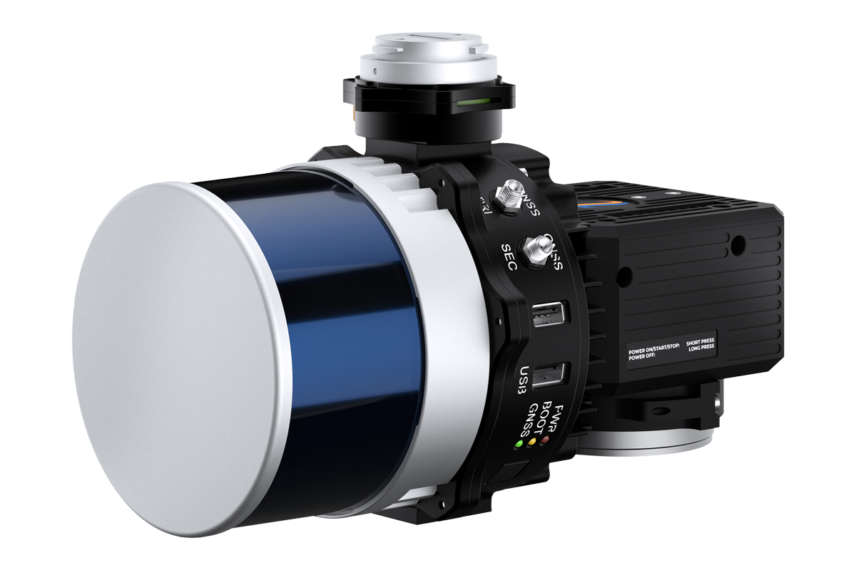
Lidar Kit – IF800 – Inertial Labs – Resepi
$2,500.00
The LiDAR Kit – IF800 + Inertial Labs RESEPI, available through Seiler GeoDrones, is a high-performance aerial LiDAR solution designed for precision mapping, surveying, and geospatial applications.
Description
The LiDAR Kit – IF800 + Inertial Labs RESEPI, offered by Seiler GeoDrones, is an advanced aerial LiDAR system built for high-accuracy geospatial data collection. Featuring the IF800 UAS, this package provides exceptional flight stability and efficiency for professional mapping and surveying applications. Integrated with the Inertial Labs RESEPI (Remote Sensing Payload Instrument), the system delivers precise LiDAR data acquisition, enhanced georeferencing, and real-time positioning. Ideal for topographic mapping, infrastructure assessment, and environmental monitoring, this powerful and adaptable LiDAR kit ensures seamless workflow integration and superior data accuracy for mission-critical operations.

")


")