Your cart is currently empty!
Software
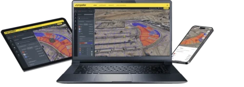
Software: Transform Drone Data into Actionable Insights
Unlock the full potential of your drone operations with our software suite for data processing, intelligent analysis, and seamless collaboration. Efficiently convert raw imagery and LiDAR into accurate foundations for extracting critical insights. Perform precise measurements, detect changes, generate reports, and share findings across teams via desktop and cloud platforms. Explore tailored solutions for agriculture, construction, infrastructure, public safety, and surveying & mapping to elevate your professional drone program. Contact our experts to find your ideal software solution.
Showing 1–16 of 41 resultsSorted by price: high to low
-

110 Pack Credits
$20,000.00 Add to cart -
70GP Unlimited
$14,000.00 Add to cart -
55 Pack Credits
$11,000.00 Add to cart -
40GP Unlimited
$9,000.00 Add to cart -
30 Pack Credits
$8,000.00 Add to cart -
PIX4Dcloud Advanced 3-year Rental
$7,990.00 Add to cart -

Annual Platform License – Scale
$7,500.00 Add to cart -
PIX4Dmatic Perpetual License
$6,990.00 Add to cart -
15 Pack Bundle
$6,000.00 Add to cart -

PIX4Dmapper Desktop Single Device Perpetual License
$5,990.00 Add to cart -
PIX4Dmatic 3-Year Rental License
$5,590.00 Add to cart -
Annual Platform License – Standard
$4,000.00 Add to cart -
PIX4Dcatch Professional 3-year Rental
$3,990.00 Add to cart -
PIX4Dmatic Yearly Rental
$3,500.00 Add to cart -
PIX4Dmapper Yearly Rental
$3,500.00 Add to cart -
PIX4Dcloud Advanced Yearly Rental
$2,990.00 Add to cart