Your cart is currently empty!
American Built, Affordable Price. Check out the all new TrueView1 LITE
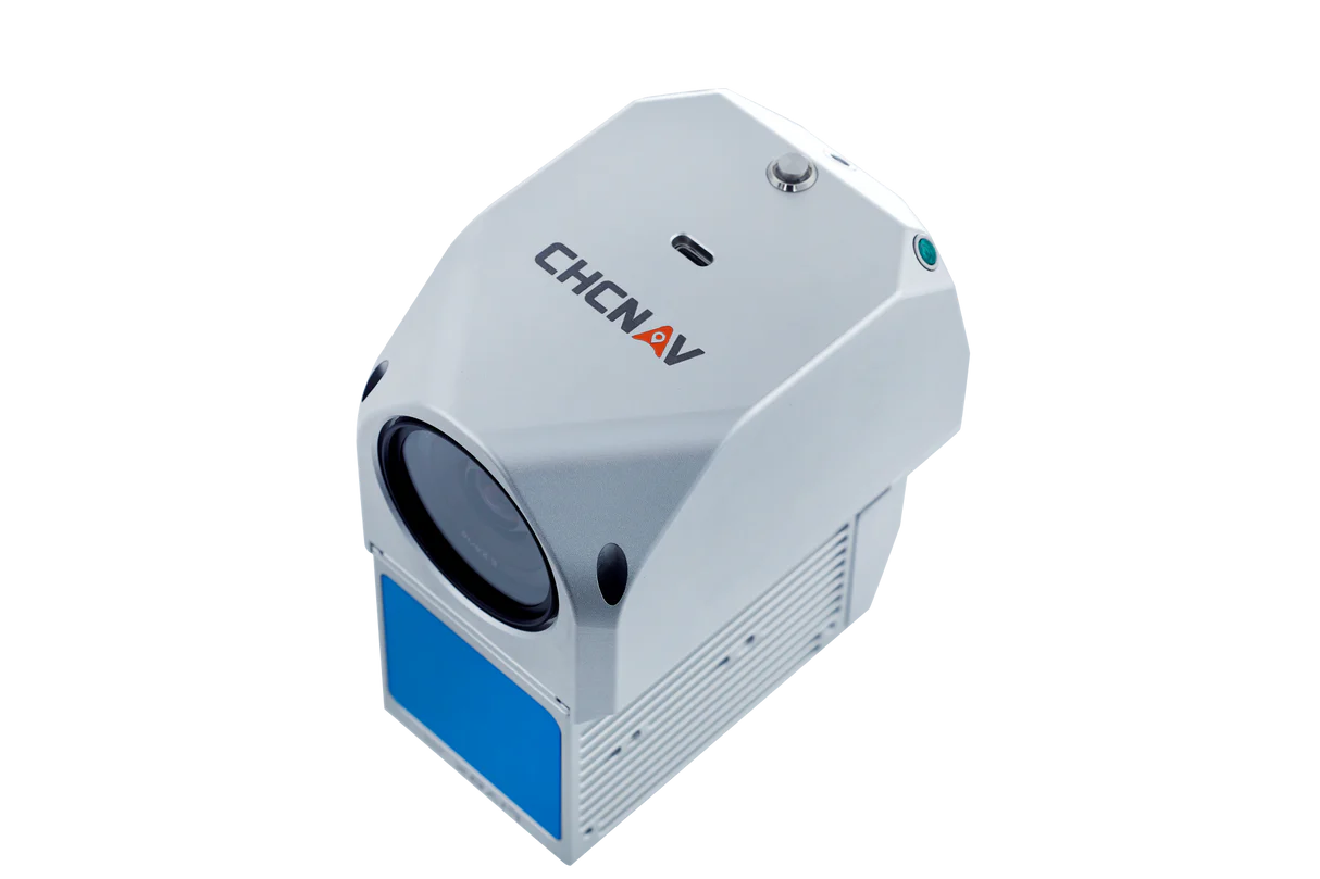
AA450 w/ 26MP Camera
$15,995.00
The AlphaAir 450 (AA450) LiDAR system is a high-performance airborne LiDAR solution designed for seamless integration with the WISPR Ranger Pro drone. With a 450-meter scanning range, high-density point cloud generation, and advanced inertial navigation, it delivers exceptional accuracy and efficiency for topographic mapping, power line inspections, and emergency response operations.
Description
The AlphaAir 450 (AA450) LiDAR system is a state-of-the-art airborne mapping solution, engineered to deliver high-precision data collection in a compact, lightweight design. Optimized for integration with the WISPR Ranger Pro drone, this powerful LiDAR system features a high-performance laser scanner, a 26 MP industrial-grade camera, and an advanced GNSS and IMU navigation system, ensuring exceptional data accuracy and reliability.
With a 450-meter scanning range and the ability to generate high-density point clouds, the AA450 is ideal for critical applications such as topographic mapping, power line inspection, emergency response, and environmental surveying. Its rugged construction (IP64-rated) and wide operating temperature range (-20°C to +50°C) make it highly durable for challenging environments.
Key Features:
✅ High-Precision LiDAR Scanning – Achieves 5cm vertical accuracy and 10cm horizontal accuracy without control points.
✅ Exceptional Data Quality – Advanced calibration reduces point cloud noise by 30% compared to similar systems.
✅ High Point Density – Captures up to 720,000 points per second with a triple return scanning mode.
✅ Lightweight & Compact – Designed for longer flight times and efficient data collection with UAVs.
✅ Integrated System – Combines IMU, GNSS, 3D scanner, and industrial-grade camera for seamless operation.
✅ Long-Range Scanning – Detects terrain and infrastructure up to 450 meters away with high precision.
✅ Reliable in Harsh Conditions – IP64-rated protection and extended -20°C to +50°C operating range.
✅ Flexible UAV Integration – Easily mounts to a variety of drone platforms, including the WISPR Ranger Pro.
Applications:
🔹 Power Line & Utility Inspections
🔹 Topographic Mapping & Land Surveying
🔹 Emergency Response & Disaster Management
🔹 Agricultural & Forestry Surveys
🔹 Infrastructure & Construction Monitoring
With its unmatched precision, efficiency, and seamless UAV integration, the AlphaAir 450 is the ultimate LiDAR solution for professional geospatial and industrial applications.
Related products

Gremsy Zio (SkyScout)
$5,500.00")
Sony ILX-LR1 (61MP) 35mm lens w/ 200m Laser Rangefinder (SkyScout)
$10,500.00
MagNIMBUS Magnetometer
$52,548.00")
RadSys Zond Aero 500 Ground Penetrating Radar
$29,580.00
Laser Falcon 2.0
$36,500.00