Your cart is currently empty!
American Built, Affordable Price. Check out the all new TrueView1 LITE
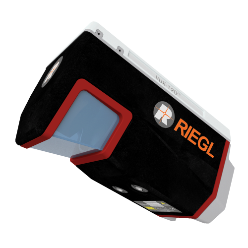
Lidar Kit – IF1200 – Riegl Vux-120
$2,500.00
The RIEGL VUX-120 is a high-precision LiDAR scanner designed for UAV-based corridor mapping and terrain surveys. With a 100° field of view, 2.4 MHz pulse repetition rate, and three-directional scanning, it ensures comprehensive data capture for power line inspections, urban mapping, forestry, and more. Lightweight and versatile, it’s ideal for UAVs, helicopters, and small aircraft.
Description
RIEGL VUX-120 – High-Precision LiDAR for UAV Corridor Mapping
The RIEGL VUX-120 is a lightweight, high-performance airborne LiDAR scanner designed for high-density corridor mapping and complex terrain surveys. With a 100° field of view, 2.4 MHz pulse repetition rate, and the ability to scan nadir, forward (+10°), and backward (-10°), it ensures unparalleled data completeness—even in vertical structures and narrow canyons.
Key Features:
✅ Unmatched Data Capture – Three-directional scanning enhances accuracy in challenging environments.
✅ High-Speed LiDAR Performance –
- Up to 2.4 MHz laser pulse repetition rate
- Up to 2,000,000 measurements per second
- Up to 400 scan lines per second
✅ Extended Flight Capability – Operates at altitudes of up to 720m (2,350ft).
✅ Compact & Lightweight – Weighing only 2.3kg (4.4 lbs), ideal for UAVs, helicopters, and small manned aircraft.
✅ Flexible Data Storage & Integration – - 2TB internal storage & removable CFast card
- Supports external IMU/GNSS systems & up to two cameras.
Ideal Applications:
🔹 Corridor Mapping – Power lines, railways, pipelines
🔹 Urban & Infrastructure Surveying
🔹 Topographic Surveys in Open-Cast Mining
🔹 Archaeology & Cultural Heritage Documentation
🔹 Forestry & Agricultural Mapping
High-Performance LiDAR for UAV Professionals
Designed for detailed mapping, surveying, and remote sensing, the RIEGL VUX-120 delivers unmatched precision and efficiency for demanding aerial applications.
Seiler Geodrones is proud to offer the RIEGL VUX-120, delivering next-generation LiDAR technology for UAV-based geospatial solutions.
Related products

PhaseOne iXM-100 – IF1200 Payload
$65,000.00
Lidar Kit – IF1200 – Riegl MiniVux3
$2,500.00
Lidar Kit – IF800 – PLS – Recon-XT
$2,500.00-
Lidar Kit – IF800 – Riegl MiniVux3
$2,500.00 
Sony ILX-LR1- IF1200 Payload
$8,500.00